Wednesday, January 25, 2023

Lake Monroe - Doyle & Brantley - Part 4 of 4

FORT MELLON MONTH, Part 4 of 4 

Doyle and Brantley at Mellonville

Mellonville 
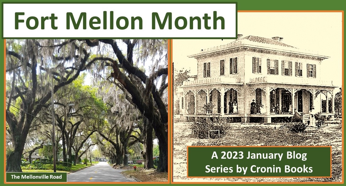
Road of today and yesteryear’s Doyle Residence at Mellonville

More like that of a scene out of a Wild-West picture show, it’s not easy today to imagine 300 to 400 painted warriors storming the Lake Monroe beach in their attack on Encampment Monroe. A fierce battle however did in fact occur on the south shore of Lake Monroe on 8 February 1837, a Seminole Indian War clash which forever changed Central Florida. 

The Grave of Capt. Charles Mellon

The most noticeable change occurred within days of the incident, with Encampment Monroe being renamed Fort Mellon in honor of the one fallen comrade, Captain Charles Mellon (Part III). The battle of 8 February 1837 was but the beginning of a series of claimed land ownerships that, by the 1880s, would officially establish a gateway for Central Florida settlers.

Coming in February: Fort Gatlin Month

While the Army fought for control of Lake Monroe’s south shore in 1837, a battle of a different nature was already underway at the U. S. Supreme Court in Washington, DC. A Morocco native named Moses was arguing before the court that the very same Florida Territory property, 12,000 acres to be exact, rightfully belonged to him. Spain, said Moses E. Levy, had granted this land to him, and on these 12,000 acres he planned to establish a homeland for persecuted Jews of Europe. Levy had won his case, but the United States filed an appeal.

Spanish Land Grant map of 12,000 acres on Lake Valdez

Moses Elias Levy Grant

Lake Valdez was renamed Lake Monroe

Meanwhile, back in the Florida Territory, two soldiers of the Second Indian War, recruits from the North who survived the six-year War, remained behind as their comrades began to pack up and return home. And the two who stayed in 1842 forever changed Central Florida.

Henry A. Crane of New Jersey and Augustus J. Vaughn of Virginia both remained at their posts – literally – after victory had been declared. Crane and Vaughn became the first settlers, two of the bravest of brave who claimed homesteads south of Lake Monroe.

Henry Crane homesteaded fortress Mellon and 160 acres surrounding the abandoned fort. He established a settlement there, naming it Mellonville. The pier on Fort Mellon built by the Army became a port of entry for private citizens, a landing spot for the earliest steamboats to offload settlers – more of the bravest of brave Central Florida pioneers.

Augustus Jefferson Vaughn homesteaded Fort Reid, a supply fort 1.5 miles inland that had been established just prior to the end of the War. Vaughn selected 160 acres which included the old fortress, and he too established a settlement, naming it Fort Reid (misspelled Reed in 1846 by an early surveyor). [A visitor to Fort Reid in 1873 met an “old gentleman,” Augustus Vaughn, and asked if he could see the fort and its soldiers. Augustus Vaughn replied, “This is the fort, and I am the soldier”]

Fort Mellon and Fort Reid were connected by a trail 1.5 miles long, the first part of a trail that was 22 miles long and known in the 1840s as the Fort Mellon to Fort Gatlin Road. In the 1850s this trail became the Mellonville to Orlando Road, and, for the short portion still in existence, is now known as Mellonville Road.

Coming in March: SARASOTA Month

Settlements Mellonville and Fort Reid were both established in 1842, prior to the Homestead Act Amendment requiring homesteaders to select acreage at least two miles or more from an Army post. Central Florida pioneer Aaron Jernigan arrived in 1843, desiring to homestead Fort Gatlin, but was required instead to choose land that was two miles from the fortress Gatlin – a story best told next week – during Fort Gatlin Month – our countdown to Pine Castle Pioneer Days series.


As Mellonville began developing on the shore of Lake Monroe at the old fortress, the Supreme court in Washington, DC, ever so slowly deliberated the fate of the Moses Levy Grant. In 1850, 18 years after Levy had filed his Spanish Land Grant lawsuit, a final decision was handed down giving Moses E. Levy his land. Then a resident of St. Augustine, Levy was awarded all 12,000 acres, and the Court also ordered a surveyor to return to Central Florida to establish boundaries of the Levy Grant.

Eastern boundary of 1850 Mellonville Survey

Surveyor Arthur Randolph found half of Mellonville, including the Lake Monroe wharf, to be located on property belonging to Moses Elias Levy as of 1850. The 1842 Homestead of Henry A. Crane was voided, and Crane thereafter departed Orange County.

Moses E. Levy sold his 12,000 acres on the south shore of Lake Monroe to an Irishman, Joseph Finegan, who soon after became Florida’s Brigadier General during the Civil War. Finegan sold his 12,000 mostly undeveloped acres to a Northerner, Henry S. Sanford, who in turn sold most of his unsold city of Sanford to a consortium of English Investors.

Although Joseph Finegan still owned most of the 12,000 acres in 1867, one small parcel had been sold to Michael J. Doyle and George C. Brantley, two Civil War veterans who decided to establish a General Store on the south shore of Lake Monroe near the old Fort Mellon Wharf. The Doyle & Brantley store welcomed a new generation of settlers to Orange County - a remarkable generation of dreamers - and doers - from around the globe.

In later years the gateway would shift one mile to the west, but during the 1870s, the First Road to Orlando opened the way to development of the Central Florida we know and love today.  

My Five-Star Rated First Road to Orlando is available at Amazon.com

 Available also at my CroninBooks Booth next to the HISTORY TENT

Pine Castle Pioneer Days, February 25 and 26, 2023

FORT GATLIN MONTH BEGINS

Next Wednesday, February 1, 2023 


Wednesday, January 18, 2023

Lake Monroe - One Dreadful February Morn


Part III – 18 January 2023:

One Dreadful February Morn


8 February 1837 

Camp Monroe had been established along the south shore of Lake Monroe in late December 1836, but troops had yet to be ordered to leave their post to explore inland. The soldiers reportedly stayed near Lake Monroe. Well to the south, where a town of Orlando would one day be established decades later, was still considered deep in Indian territory. The Army considered the region around Lake Monroe to be “deep in the part of the country in which the great body of the Seminole Nation is concentrated.”

Despite constructing a fortress on the shore of Lake Monroe in December 1836, those stationed at the fort stayed put. And instead of going in search of the enemy, the enemy came looking for them. The Charleston Mercury of 22 February 1837 published a report written by Colonel Fannin, who had been stationed at Camp Monroe, on the events of 8 February 1837.

“A battle occurred on the morning of the 8th of February at the Encampment Monroe, at the head of Lake Monroe. This post was attacked at 5 o’clock in the morning, and a brisk firing kept up by both parties until 8 o’clock, when the Indians retreated.” Colonel Fannin, in command of about 250 regulars at that day, wrote “Captain Mellon, U S Army, was killed. Lieutenant J. T. McLaughlin and 14 privates were wounded. The hostiles were estimated at 3 or 400 strong.”

This February: Fort Gatlin Month

Countdown to Pioneer Days

The “Encampment Monroe” name was changed immediately to Fort Mellon, a fact that can be establish in the very same dispatch from Colonel Fannin: “The above intelligence is confirmed by the arrival at this place on Tuesday night last, of the Steamer Cincinnati, Capt. Curry. The attack on Fort Mellon, Encampment Monroe, was made, it is supposed, by Philip and his gang.”


Pensacola Gazette, 2 September 1837

THE GRAVE OF MELLON” was the Pensacola Gazette headline of 2 September 1837: “On the south shore of Lake Monroe, in Florida, on the very ground where the battle of the 8th of February was fought against the Seminoles, may be seen a little rectangular colonnade of palmetto pickets, enclosing the hallowed spot where are deposited the mortal remains of Capt. Mellon. Over his grave is placed a broad tablet, of that rare and peculiar stone which is only found in certain localities in Florida, and on it is chiseled the name and rank of the departed, with a notice of the manner and occasion of his death:

“Though remote from the haunts of civilized man, that grave still bears the token of human skill and affection. Though the ground is not consecrated by religious ordinance, as the prescribed sanctuary of the dead, it is consecrated in heroic story as the field of martial triumph. Could a gallant soldier desire a better resting place?”

Coming in March: Sarasota Month

Our Shared Heritage

“Mellon received a rifle shot in his breast very early in the action, and before the shout was heard which proclaimed victory along our lines, he had breathed his last. Although attacked by six hundred ferocious savages, bent on an indiscriminate massacre, and persevering for three full hours in the hope of accomplishing their purpose, our troops, but little more than half their number, and all recruits, nobly breasted the showers of rifle balls poured upon them, and so dealt with their assailants in turn, as would have done honor to veterans. In all the war, the Seminoles have never been more severely punished than at Lake Monroe. The only martyr on our post was Mellon, and the handsome stockade fort, now established there, is called by his name.”


First Road to Orlando (2016) by Richard Lee Cronin

The Dade Pyramids, National Cemetery, St. Augustine

After War’s end, the bodies of all fallen soldiers were removed from their temporary burial places established during the war and reinterred beneath three Dade Pyramids at the National Cemetery in St. Augustine.

Next Wednesday: Doyle & Brantley of Mellonville, Florida

Wednesday, January 11, 2023

Lake Monroe - Christmas 1836


Encampment Monroe, Christmas 1836 


Lake Monroe and namesake, President James Monroe

A year after sixteen plantations were burned to the ground in northeast Florida, Army troops, accompanied by volunteer Militia from Alabama and Georgia, began arriving at Lake Monroe to establish a supply post. The troops built an “encampment,” said dispatches, and named their new lakeside fortress Camp Monroe. The lake itself, previously known as Lake Valdez, while Florida was under Spanish Control, had only recently been renamed in honor of our Nation’s 5th President. Florida’s acquisition had been accomplished while James Monroe (1758-1831) was President, his term ending in 1825.

Orders given at the time were to build and occupy the camp but await further instructions before exploring inland, and so for 250 regular soldiers and 39 friendly Indians under command of Lieutenant Colonel Fannin, spent a lonely Christmas in December 1836 on Lake Monroe.


Sanford Historical Marker at Site of Fort Mellon

 Intended to serve as a supply fortress for delivery of soldiers and material to the region, a pier was constructed on Lake Monroe so that steamboats could dock. That dock was located one mile east of present-day Sanford, where today Mellonville Road begins a southbound journey that originally took the road 25 miles south, through utter wilderness, to Fort Gatlin. Beginning in 1842, this pier served as the gateway for incoming settlers coming to claim a homestead, but first, the Army had a job to do.

The Military had begun to mobilize in Florida soon after the two hostilities of the prior Christmas. Among those first to arrive was General Winfred Scott, arriving at Volusia Landing, the plantation and outpost founded in 1821 by Horatio S. Dexter (Part I). Scott, on April 24, 1836, eight months before Encampment Monroe was established, wrote of reaching Volusia Landing on the St. Johns River, just south of Lake George, where he awaited the arrival of General Abraham Eustis.


Upcoming Blogs for the First Quarter 2023

www.CroninBooks.com


General Scott’s dispatch also said he found the Steamer Essayons docked at Volusia, and so while waiting on General Eustis, decided to “embark in her, and with a guard of only seventeen men determined to penetrate, by the St. Johns River, the southern part of the peninsular as far as practicable.”

The purpose of the expedition, said Scott, was to test the navigability of the St. Johns River. Others had traveled this way before him, but as a military officer, he wanted to see for himself what was in store for his regiment should they be ordered to move further south into Indian Territory. His published report began with: “We found no difficulty in passing the bend of Lake Monroe.” That would have been the sharp 90 degree bend the river takes just prior to entering Lake Monroe from the west.

Essayons passed into and then across Lake Monroe, we learn from General Scott’s dispatch, then attempted to enter the small passageway connecting Lake Monroe with Lake Jesup. “We found the river beyond the lake nearly as bold as below,” wrote Scott. A sandbar prevented Scott’s expedition from entering Lake Jesup, so he added, “We do not doubt that we might have gone fifty or seventy miles further to Cape Canaveral, but unfortunately our boat drew more than four feet, and we only found four on the bar.”  Scott was writing about the portion of St. John’s River that connects the easternmost end of Lake Monroe with Lake Jesup.


Second Indian War Generals Scott and Eustis

General Scott’s April 1836 report added: “I was anxious to discover whether the Indians had any settlements on the upper part of the (St. Johns) river: and to find out the place of concealment of their women and children”. Scott concluded by saying his curiosities were answered when they (Indians) “fired upon us from a distance of 300 yards.”

Scott’s expedition returned to Volusia Landing, where on 25 April 1836, General Abraham Eustis arrived. Even then however, Eustis had little time to attend to future military plans. He was instead forced to instruct troops to evacuate. “Volusia”, wrote Scott, “for it had already become extremely sickly. Many cases of malignant bilious fever had occurred which, in the opinion of some of the physicians, threatened the approach of the yellow fever.”

Christmas fires of 1835 had been the reason for the Army coming to Florida. One year later, Lieutenant Colonel Fannin and his regulars found little reason to celebrate the coming of a New Year. But as bad as 1836 had been for the Army, 1837 was about to get much worse.

Much, much worse!

Next Week: Camp Monroe, 5 AM, 8 February 1837

Wednesday, January 4, 2023

Fort Mellon: The Christmas Fires of 1835

FORT MELLON MONTH – January 2023

Part I: The Christmas Fires of 1835


New Smyrna Sugar Mill Ruins

Forty years before Sanford was founded as the ‘Gateway to Orange County’ (the place we now know as Sanford of Seminole County), a pier was constructed a mile east on Lake Monroe that first served as the entry point for many of the area’s earliest pioneers. Built in December 1836 for steamboats needing to offload troops and supplies, the pier, by 1843, welcomed visitors and settlers to village of Mellonville, a community built around where ruins of a old fortress were still visible.

Mellonville was the first permanent settlement south of Lake Monroe, the original “gateway” to Central Florida, a village named for Fort Mellon of Lake Monroe. Sanford's Mellonville Road, shown in the photo below, the first Central Florida "road," still heads south from Lake Monroe today. 

Mellonville Road of today heading south from Lake Monroe

Although Mellonville was in fact built on the lake's southern shore, before Statehood, back in the days the ‘Florida Territory,’ many considered this land to be on the west side of the lake.

South versus west is an important distinction, because all land on the west side of the St. Johns River back then was deemed Indian Territory. Although the St. Johns River meanders south to north on its long journey to Jacksonville, the river, as it flows through Lake Monroe, is flowing east to west.

Fact is, Sanford and Orlando were considered in Indian Territory during the days of Mosquito County, and that is why there were no settlements in these parts. When the Army established their fortress on the south side of Lake Monroe in December 1836, they were in fact on the northern fringe of Indian Territory. And they built their fort at this location because of the Christmas Fires of 1835.


Lake Monroe before Settlements

Horatio Dexter (1785-1834), namesake of Lake Dexter and founder of the Volusia Landing, both of which are on the east side of the St, Johns River, described in 1823 the generally accepted but unofficial boundaries first “accepted” in 1763 by the Brits while they controlled Florida. Horatio Dexter said the boundaries “seem never to have been overstepped by the Spaniards” when they assumed control of Florida. But he was obviously unaware of the tens of thousands of acres in Spanish Land Grants – such as the Levy Grants at Micanopy and Lake Monroe – all of which were smack dab in the middle of that supposed “agreed to" boundary of the Indian territory.

Fact is Florida landholdings were a mess when the United States took control in 1821. There was a smattering of Colonials from the North who had become landowners, like Horatio Dexter from Connecticut. The American Indians supposedly owned land west of the Ocklawaha and St Johns Rivers west to the Suwannee River – meaning one could not travel from Tallahassee to St. Augustine without crossing Indian Territory. There were British Loyalists too, owners of large plantations east of the St. Johns all the way to and including the Atlantic Coast. These folks had escaped the colonies during the Revolution, and were not thrilled to learn they were again part of the colonies they had escaped from. Spanish landowners owned a piece of Florida too, land granted to them while Spain had control. And a few of the Spanish Land Grant holders – such as Moses E. Levy of Morocco, came to Florida from other parts of the world. Then too there were runaway slaves from the North. 

A melting pot the Florida Territory was indeed, but its many factions were not blending together. And by late 1835, the melting pot was about to boil over. The Dade Massacre of December 1835 occurred on the trail between present day Ocala and Tampa, and around Christmas of 1835, Indians attacked and set ablaze a total of 16 plantations east of the St. Johns River. Residents of St. Augustine reportedly saw the black smoke on the horizon off to the south, in the direction of New Smyrna Beach.

News traveled slowly in 1835. Vessels docking in the North delivered the news, so it was not until January 1836 that tragic stories of “scalped” women and children made the newspapers in the North. Following these two December attacks, the United States declared war on the Indian Nation.


Meanwhile, the Indians had retreated to the south, crossing Lake Monroe, to return to their land on the "west side" of the St. Johns River.

As the United States Began mobilizing troops to go in search of the warring Indians, fortresses were strategically located between the settlements along the east side of the St. Johns River and the borders of the Indian Nation on the west side. Fort Butler was established across the river from Horatio Dexter's Volusia Landing. Fort Christmas was built near the southeastern terminus of the St. Johns River, inland from the Atlantic Ocean. And “Encampment Monroe” was built and staffed at Lake Monroe - to guard against Indians trying to return to the river's "east side." No order was given however to travel inland from Lake Monroe, not yet anyway.

Next Week: Part II - Encampment Monroe 1836

This Series is Sponsored by the 5 Star Rated


First Road to Orlando, by Richard Lee Cronin

Available at Amazon.com and In-Person History Events

See my In-Person Events Schedule at www.CroninBooks.com