Thursday, February 25, 2021

Pine Castle Pioneers / Pine Castle Lakes - Part 3


Pine Castle Pioneers / Pine Castle Lakes

Celebrating Pine Castle Pioneer Days ONLINE – Part 3


Part 3: Devil’s Bay and Rattlesnake Lake

When last we wrote of Surveyor Benjamin F. Whitner and his two assistants, as you may recall, it was Spring of 1843. Three brave souls were mapping, for the first time ever, South Orange County. Starting at Point Zero near Lake Lancaster, the survey party had worked west, clearing a straight path for six miles to a point that is today Valencia Community College on Kirkman Road. Here, at the “Northwest” corner of Pine Castle Township of 1890, Part 2 of my series ended. And it is at this “Northwest” point where, in 1843, Whitner’s survey team made a sharp turn, and began clearing another straight path – this time southbound - for another six miles. Here, at the “Southwest” corner of Pine Castle Township, was the location later surveyors called “Devil’s Bay”.


Orange County map of 1890 of “Devil’s Bay”.

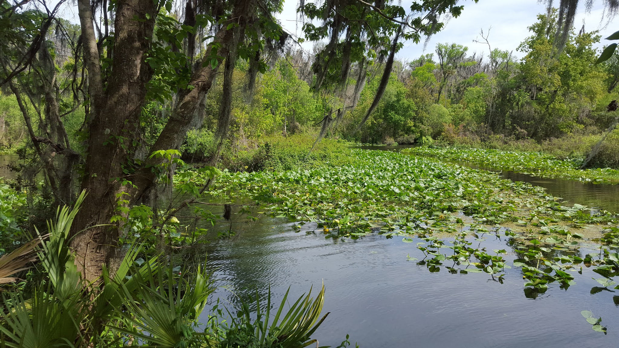
A bay is most often associated with a coastal waterway, but 19th century surveyors identified some inland areas as a “bay” too. Central Florida has several lakes named “Bay”. In my Orlando Lakes: Homesteaders & Namesakes book I reference a Will Wallace Harney article of May 1875 in which he writes of “a picnic and fish frolic at Bay Lake”. This lake is south of Pine Castle, and still known by that name today. The 1890 map of Orange County shows Pine Castle’s Bay Lake as the headwater for Boggy Creek.

Devil’s Bay of 1890 was just west of the southwest corner of Pine Castle Township (see arrow on map above). Homesteader SELBY HARNEY, the nephew of Will Wallace HARNEY who came to Florida with his uncle in 1869, lived here alongside Devil’s Bay in the 1880s (see L shaped parcel outlined in red on map above). Selby & Trinity (Yates) Harney resided here during Florida’s Great Freeze of 1894-95, lost their crop, and then moved further south. The abandoned Selby Harney Homestead, in the 20th century, changed hands several times before eventually becoming part of the Martin Marietta complex.

Where exactly is Devil’s Bay? The Orlando Eye, known as The Wheel at Icon Park, is now located where the “35” appears on the map above.

1954 Aerial of Devil’s Bay area Orange County

The aerial photo above was taken before Martin Marietta, and the red arrow (added) points to a depressed area referred to in 1890 as Devil’s Bay. The easternmost shores of Big and Little Sand Lake are visible on the left side of both the 1890 map and the 1954 aerial photo above.

When Whitner’s 1843 survey team arrived at the southwestern-most corner of Pine Castle Township, the first township surveyed in Lake, Orange, Osceola, and Seminole Counties, the survey party then turned back east. At this point near Devil’s Bay, they began clearing a straight six- mile journey in the direction of today’s Orlando International Airport.

Surveyors pitched tents and set up camps wherever they ended a day’s work, typically said to be about every twelve land miles daily. But the surveyors mapped more than the outer limits of Pine Castle Township, for their task included mapping the entire township, dividing it into 36 individual square-mile Sections. One Section, for example, was the square-mile Section 10, surveyed in 1843 by Whitner and his team. Brothers Isaac and Aaron Jernigan, later that same year, applied for two homesteads of 160 acres each, half of the Section 10 surveyed by Benjamin F. Whitner.

Pine Castle Township Section 29, shown on the 1890 Orange County map above, contains a red square added by this author. Inside that square, dotted lines intersect at a bold black line. This red square is the only alteration I made in Section 29, and I say this because the contents within that square – sketched 130 years ago, – tell a fascinating story of early Orange County.

The bold black line crossing Sections 29 and 32 (top to bottom) is SHINGLE CREEK. Dotted lines are early trails. The trail from the upper right in Section 29 down through Section 31 is nearly identical to John Young Parkway of today. The other trail leaving Section 29 on the right, ends at the 1890 town of Pine Castle. Note too how surveyors show a line, “or ridge” of trees – an Oak Ridge, along each side of Shingle Creek, a riverboat highway during the 1870s and 1880s.

The area east of Section 29 on the same 1890 Orange County map is shown below. Note how the trail leaving Shingle Creek curves northeast to the town of Pine Castle (red star). An orange arrow (added by me) on the map below points to yet another item of interest – RATTLESNAKE LAKE.

One of two 1890 Orange County Rattlesnake Lakes, this one, as reported on page 245 of my Orlando Lakes: Homesteaders & Namesakes, was later renamed ELLENOR for the daughter of Willard & Lena Van Duzor, details of which can be found at Lake ELLENOR on page 89 of my book. “The red blood curdles and hard bones quake,” wrote Will Wallace Harney of Pine Castle in the 1870s, “at the whir of the deadly Rattlesnake.

Perhaps a warning for those approaching the two Rattlesnake lakes, later developers, no doubt desiring to attract buyers for their developments, changed both Rattlesnake Lakes, opting for more pleasant names. Female names, Ellenor and Kathryn, were selected for each body of water. Where, you might ask, is Kathryn? That one-time Orange County Rattlesnake Lake is now part of Seminole County.

1890 Orange County map of Rattlesnake Lake and Pine Castle


Pioneer Days weekend would have been this weekend had it not been cancelled due to the pandemic. The Pine Castle Historical Society was to again sponsor the “History Tent”, and I had been invited to do an in-person presentation of Pine Castle Pioneers / Pine Castle Lakes. Instead, I have adapted my talk to this online format, a four-part series, the conclusion of which will be the next post. In the meantime, I invite you to check out my books either at my webpage or my Amazon Author Page. (You can click Follow Author on my Amazon author page and receive alerts about new publications as they come online).

Pine Castle Historical Society awarded me their 2017 Historian Award for my book, Beyond Gatlin: A History of South Orange County, and much of this four-part series was taken from that book as well as Orlando Lakes: Homesteaders & Namesakes, an encyclopedia-style book of how 303 central Florida lakes came to be settled and named. Both books can be purchased at Amazon.


On March 17, 2021, I will be the online guest speaker at the Orlando Remembered Group meeting which begins on Zoom at 9:30 AM. My talk is entitled, Harriett, Henrietta & Orlando’s Girl School, in honor of Women’s History Month (for details email Rick@CroninBooks.com ).

On March 25, 2021, Winter Garden Heritage Foundation is sponsoring my live on-line presentation of, When Winter Garden was Oakland. Details on how to tune in to this special West Orange County presentation will be posted as the date approaches.

IF YOU ENJOY CENTRAL FLORIDA HISTORY, YOU WILL LOVE

  CRONINBOOKS.com

Your On-Line central Florida History Bookstore

Visit my Amazon Author Page: https://www.amazon.com/author/richardcronin


Read reviews and purchase books at my Author Page above


Orlando Lakes: Homesteaders & Namesakes (2019)

THE AWARD WINNING - Beyond Gatlin: A History of South Orange County (2017)

First Road to Orlando (Second Edition 2015)

The Rutland Mule Matter – A Novel (2015)

CitrusLAND: Curse of Florida’s Paradise (Second Edition 2016)

TAVARES: Darling of Orange County, Birthplace of Lake County (NEW in 2020)


Perfect for WOMEN’S HISTORY MONTH


FLORIDA’S INDIAN RIVER DUCHESS

Download for only $3.79!


Author for Pine Castle Historical Society Publication:

Will Wallace Harney – Orlando’s First Renaissance Man


Tuesday, February 16, 2021

Pine Castle Pioneers / Pine Castle Lakes - Part 2


Pine Castle Pioneers / Pine Castle Lakes

Celebrating Pine Castle Pioneer Days ONLINE – Part 2


Orange County’s FIRST paid job: Clear a straight path SIX MILES long!  


ORLANDO, settled in 1856, is not in PINE CASTLE Township. Orlando Township, six miles by six miles like that of Pine Castle Township, was not surveyed until April 1846, three years after Pine Castle Township had been surveyed by Benjamin F. Whitner.

Arriving in Mosquito County at Lake Monroe in 1843, Surveyor Whitner followed a sand-rutted military trail south, skirting after nearly 15 miles the abandoned fortress Maitland, then proceeding south past a swamp area known today as Lake Eola. Whitner and two laborers, Hale and Randles, continued down the wilderness trail, strolling a narrow winding path through towering pine trees and scrub brush - now Magnolia Avenue in the heart of downtown Orlando - then continuing another mile before finally stopping to set up their equipment to begin work.

They may well have been the only living souls in all of Pine Castle Township that first day, the day Benjamin Whitner began surveying the northernmost line of what was to be 540 square miles of mapping – the very first of which was 36 square miles that later surveyors would call Pine Castle Township, a landmass beginning just north of present-day Kaley Avenue, shown as the top red line on the 1879 map of Orange County below.


Pine Castle Township (red square) on the 1879 Orange County map above shows 4 named lakes in the 36 square miles: Clear; Holden; Jessamine and Conway. (Note unnamed Lake Lancaster in upper right corner of red square.

Below: Benjamin Whitner’s 1843 survey of the southern portion of Clear Lake. 


Surveyor Whitner worked his way south from the starting line until reaching present-day Kissimmee. In the 1840s, Benjamin F. Whitner of Florida’s Panhandle, with the help of two “chainmen”, surveyed 540 square miles south of downtown Orlando. Whitner then, after finalizing the surveys, began buying land inside the Pine Castle Township, acreage where he had first begun his surveying work in 1843.

We do not know why Whitner bypassed 23 miles of wilderness prior to starting his survey work. What we do know is that Benjamin Whitner was unlike most every other surveyor who worked in central Florida during the 1840s. Most were roving surveyors, meaning they moved from one territory to the next as the U. S. Land Office needed surveying completed in its new territories. Most of those who surveyed central Florida moved on to Nevada and California by the 1850s. But Benjamin F. Whitner of Madison, Florida was different.

First to survey land in Orange County, Whitner was also among the first to buy Orange County land (beginning in 1851). He was among the first to cultivate Orange County land (farming sugar cane at Lake Gatlin in the 1850s). He was among the first to serve as an Orange County Commissioner (1867); and was a partner (with William M. Randolph) in constructing the first ever free-standing hotel in Orange County (1869). There is good reason to believe Whitner was first to conceive of a railroad to run from Lake Monroe to Tampa Bay.

For 38 years (1843 - 1881), Benjamin F. Whitner worked as an active participant in settling and promoting two of the earliest settlements south of Lake Monroe, Fort Reid and Fort Gatlin.

Of the many lakes surveyed in 1843 by Whitner in Pine Castle Township, he named only two, Clear Lake and Lake Conway. All other lakes in the township were named after 1843, with most being named in the 1870s and 1880s by early pioneers who homesteaded on or near each lake. Whitner is believed however to have named, in the 1860s, Lake Gatlin, where he then owned nearly 300 acres.

Of the two lakes named by Whitner, Lake Conway memorialized his 1843 boss, Florida’s Surveyor General, Valentine Y. Conway (1803-1881) of Stafford County, Virginia. And perhaps impressed by the clarity he found at one other, Clear Lake is identified by that name on Whitner’s 1843 survey (see above). Other lakes surveyed by Whitner were simply noted as a “Pond”.


In the late 1870s, Dr. Robert Hamilton McFarland named Lake Lancaster, as I explain on page 171 of my book, Orlando Lakes: Homesteaders & Namesakes.

Doctor McFarland had married Sarah Lancaster at Fulton, IL on March 11, 1847, and a daughter, Rosa Lancaster McFarland, had been born prior to the doctor relocating his family to Orlando. The southernmost tip of Lake Lancaster, likely the first “Pond” Whitner surveyed, remained unnamed nearly 40 years until Dr. McFarland lent his wife’s maiden name to the lake – a name it is still known by these many years later.

“The water in Lake Lancaster in those days,” wrote one 1880s pioneer, “came up to the road and as we stopped to water the horse on our way to the village, many alligators would slide into the water only to come back again to the warm sand as soon as we had gone. Mother was young, slender, and about five-feet tall, but did her share of snake killing and one day killed a six-foot rattler”.

Located near “Point Zero” of Pine Castle Township, as I explain in Part 1 of this series, Whitner and two chainmen would have worked their way west along the north line of “Township 23 South; 29 East”, or as surveyors of 1890 called it, Pine Castle Township”. (As stated in Part 1, the name “Pine Castle Township” was applied to this area not by Whitner, but rather by surveyors in 1890).


1890 Pine Castle Township (page 1 - Lake Lancaster at top center) See note in upper right corner

To fully appreciate the difficult challenges three courageous souls confronted in 1843, I borrow this excerpt from ‘Taming the Illinois Wilderness’ by Author Pat Camalliere:

Imagine hills, valley, rivers swamps, woods, etc. A typical location such as a heavily wooded area required surveyors to run a straight line through the woods from one fixed endpoint to the next. An axe man would clear a path through the trees and the underbrush while a flagman provided a sighting target for the surveyor. Once the straight line was cleared, two chainmen would measure and set a mark identifying the distance. The surveyor would then bring up the rear, sighting using a compass to make sure the crew stayed on course. A good surveying party could survey about 12 miles in one day.”


Surveyor Whitner’s first “endpoint” was “Point Zero” near Lake Lancaster, as defined in Part 1 of this series, at the intersection of Curry Ford Road and Ferncreek Avenue. The other “Endpoint” was six miles due west, at the opposite end of Pine Castle Township. And along the way, while clearing the brush and trekking through swamps, there were those alligators and snakes later pioneers spoke of.

Six miles due west of Lake Lancaster today is Kirkman Road’s centerline, at Valencia Community Campus in Metro West. The campus encircles charming Lake Pamela, (page 230 of Orlando Lakes: Homesteads & Namesakes) a modern-day name for a body of water once known as Lake Moody. Pioneer Jacob Moody owned land here in 1912, although before that, William Thompson of Washington, DC had owned this land. Thompson, Chief Engraver for the United States Coast and Geodetic Survey, had died in 1901. Of this man it was said: “The numerous copper plates in the archives engraved by him show the excellence of his work and form an enduring monument to his patience and industry.”

In my next installment, Benjamin Whitner’s surveying crew leaves Lake Pamela and heads in the direction of Devil’s Bay of 1890. Care to guess where that water feature might have been?

CRONINBOOKS.com

Your On-Line central Florida History Bookstore

Visit my Amazon Author Page: https://www.amazon.com/author/richardcronin


Read reviews and purchase at my Author Page above


Orlando Lakes: Homesteaders & Namesakes (2019)

THE AWARD WINNING - Beyond Gatlin: A History of South Orange County (2017)

First Road to Orlando (Second Edition 2015)

The Rutland Mule Matter – A Novel (2015)

CitrusLAND: Curse of Florida’s Paradise (Second Edition 2016)

TAVARES: Darling of Orange County, Birthplace of Lake County (NEW in 2020)


Author for Pine Castle Historical Society Publication:

Will Wallace Harney – Orlando’s First Renaissance Man


Thursday, February 4, 2021

Pine Castle Pioneers / Pine Castle Lakes - Part 1


Pine Castle Pioneers / Pine Castle Lakes

Celebrating Pine Castle Pioneer Days ONLINE – Part 1


"Pine Castle Township" of 1890 Orange County 

During the year 1890, under the watchful eye of county surveyor John Otto Fries, surveyors began a massive project having as its goal to identify and map every Orange County property owner as of that year. Their task was enormous, for not only did the county's homestead deeds date as far back as the 1840s, when brothers Aaron & Isaac Jernigan arrived in this remote wilderness then called Mosquito County, but many parcels had since changed hands. Indeed, some parcels had changed hands multiple times.


 1890 Orange County Townships (Included Seminole County of today)


The 1890 project began by using the original 1840s surveyor system of township and ranges. The 1840s surveys were an amazing accomplishment as the project required courageous surveyors to trek through palmetto brush, swamps and lakes, and the unchartered Mosquito County to map the area into increments, or townships, of 36 square miles. Each 1840s township was 6 miles north to south by 6 miles east to west. The chart of Orange County townships above was prepared by the surveyors in 1890.

As for the 1890 project, these identical 6 miles x 6 miles townships were used, only in 1890, each township was named. The 1890 master sheet above, with Township 23 South, Range 29 East outlined in red, was named for the town of Pine Castle – the predominant “place-name” within that territory in the year 1890.

Orange County property records of today identify land using the same Township system as first laid out in 1843 by surveyor Benjamin F. Whitner. In fact, Whitner drove the FIRST stake in the ground in ALL of Central Florida in the Pine Castle Township, but did so 40 years before the name Pine Castle would become associated with Township 23 South, Range 29 East.


 Archway near Lake Lancaster and Point Zero of Pine Castle Township


It’s true! While eager Army troops in 1843 packed up and prepared to leave Mosquito County at Mellonville on Lake Monroe, surveyor Benjamin Franklin Whitner arrived, unloaded his transit and measuring chains, followed the old Fort Mellon to Fort Gatlin trail nearly 28 miles south, and drove his first survey stake into the ground to identify Point Zero of what is today the Pine Castle Township. Land at present-day Sanford on Lake Monroe was not yet surveyed, neither were areas at Maitland and Orlando.

Whitner’s first survey stake is but one chapter in the amazing story of central Florida pioneers. Point Zero, just south of the Lancaster Arch (photo above), is near the intersection of Ferncreek Avenue, Curry Ford Road, and Briercliff Drive. None of the roads of course existed in 1843, when surveyor Whitner and two “Chainmen” first identified Point Zero of the Township - 138 miles South (23 X 6) and 174 miles East (29 x 6) of yet another stake that had been driven into the ground at Tallahassee Florida.

Surveyor Whitner completed the FIRST central Florida township in 1843, and while doing so, charted 36 “Sections” which allowed for two homestead deeds to be issued in “Section 10 of Township 23 South, Range 29 East" – two deeds issued to brothers Aaron and Isaac Jernigan. Whitner, before proceeding to survey 540 square miles of South Orange County, also charted each existing lake, identifying each simply as a “Lake” or “Pond”. But of all the lakes Whitner sketched in the Pine Castle Township, he named only two, Lake Conway and Clear Lake.

Pine Castle Pioneers / Pine Castle Lakes will pick up here when my ONLINE Pioneer Days Presentation (cancelled due to the pandemic) continues.

In the meantime, here's another brain teaser: Which Pine Castle Township lake had to be shifted west during construction of the Ultimate I-4 project, and what does that lake have in common with a historic downtown Orlando highrise? 

The answer and much more in Part 2, or pages 25-26 of my book: Orlando Lakes: Homesteaders & Namesakes, available at Amazon.


A presentation of Richard Lee Cronin and CroninBooks.com 


Friday, December 18, 2020

PINE CASTLE - Home for the Holidays Part 8: The Finale!


PINE CASTLE

Home for the Holidays


Celebrating America’s 19th Century Paradise


I’ll be home for Christmas, if only in my dreams…

Pine Castle today seems more a state of mind. Google the name and the internet will inform you it is a “census-designated place in Florida”. Schedule a meeting in downtown Pine Castle and the other party will likely ask that you be more specific. A local might feel compelled to clarify they now actually live in Edgewood or Belle Isle, whereas the newcomer might ask for directions to the Pine Castle itself.

As to Pine Castle’s borders there is much confusion. The original Pine Castle, the residence built on Lake Conway in 1874 by Will Wallace Harney (shown above), the very structure for which an 1884 town of Pine Castle was named, would today pay property taxes to the Town of Belle Isle. Airplanes now land 7 miles east of the Harney's lakeside residence at Orlando International Airport, on a World War II runway named Pine Castle Airbase. At least one Pine Castle old-timer recalls a welcome to “Pine Castle” sign on Orange Blossom Trail, 2 miles west of the Harney homestead.


The Pine Castle, Pine Castle, Florida

In February 2021, Pine Castle Pioneer Days will again be celebrated at Cypress Grove Park, two miles north of Harney’s historic Lake Conway residence. But travel to this park from Harney’s place at Pine Castle – or Belle Isle of today - requires driving through the J. J. Reeves 1913 Add to Pine Castle – or today the Town of Edgewood – and then passing through the Ghost Town of Gatlin, an 1880s city founded by Edward Hobbs and son Sidney, residents of Louisville, Kentucky - Will Wallace Harney’s old stomping ground prior to relocating to Pine Castle in 1869. A town of Gatlin encircled Gatlin Hill on three sides – where Harney himself lived in yet another lakeside cabin after moving out of the Pine Castle – a cabin located on land his in-laws had homesteaded when Harney first settled further south at Lake Conway.

Confused? Suffice it to say Pine Castle is more than a present-day census-designated place. Pine Castle is a historical central Florida location - having no defined town limits. It is, as I first stated, a state of mind!


Beyond Gatlin: a History of South Orange County
IF YOU HURRY, click on the book cover above to order from Amazon
for Christmas gifting.

By Richard Lee Cronin 

Pine Castle of 1869 was in many ways synonymous with Fort Gatlin of 1838. Each were part and parcel to the settling of South Orange County, including Kissimmee, which in 1887 became part of a new Osceola County. Edgewood and Belles Isle, both 20th century creations, are reimagined communities that had previously encompassed the first 19th century settlements at Fort Gatlin - and Beyond Gatlin – South Orange County’s Gateway, Pine Castle.

With his new castle-like residence on Lake Conway finished in time for Christmas, Will Wallace Harney invited friends and neighbors to celebrate the 1874 holiday at the, “Pinecastle on Lake Conway”, on the west shore of a lake the Indians had called “Beautiful Water.” Harney himself described his residence: “The house stands on the edge of a slope, a double-winged structure around a central octagon of two stories twenty-four feet in diameter, surmounted by castellated peaks and gothic pointed roof visible at every angle.

Many Kentuckians and Virginians were present”, wrote Harney, and guests from near and far enjoyed the Orange Glee Club and an accompanying band playing such favorites as “My Old Kentucky Home.” Life in central Florida’s 19th century wilderness was anything but easy, but for one extra special Pine Castle Christmas, “the turreted, castellated pine castle glowed and sparkled like a great jewel cut in brilliant facets.”

At 11 o’clock,” wrote Harney, “the folding doors again opened; the Cherokee rose table glittering with decorations and spread with the feasts of delicate tropical fruits, wine-like coffee and the inevitable eggnog under its lace of froth, and an hour of feasting followed.”

Despite hardships, Pine Castle’s earliest settlers paused to celebrate Christmas. Tis a tradition we enjoy to this very day. Merry Christmas to you and yours!


And speaking of tradition, mark your calendar for 

PINE CASTLE PIONEER DAYS

February 27 & 28, 2021

Cypress Grove Park

Reserve a seat today for my FREE Presentation

NAMESAKES of PINE CASTLE'S LAKES


UNDER THE HISTORY TENT

Pine Castle Pioneer Days

12 NOON, Saturday, February 27, 2020

Email Rick@Croninbooks.com and ask to reserve a seat(s). I will confirm your FREE reservation, and also set aside a FREE autographed booklet,

Namesakes of Pine Castle's Lakes booklet.

BUT RESERVE TODAY - SEATS ARE LIMITED

MERRY CHRISTMAS

HAPPY NEW YEAR!

From CroninBooks and CitruslandFL


Thursday, December 10, 2020

PINE CASTLE: Home for the Holidays Part 7 - Mary E. Randolph


PINE CASTLE

Home for the Holidays


 The Randolph Bedroom, Vaucluse, Virginia,

William M. Randolph died here in 1876


Mary E. (Pitts) Randolph, Part 7 of 8


Lake Gem Mary, the smallest of three Orange County lakes which helped fortify Fort Gatlin during the Second Seminole Indian War, became known by its present-day name around 1870, the year after William Mayer Randolph bought the land on the north side of the fort. Randolph then named the small lake on his land for his wife, Mary Ellen (Pitts) Randolph.

Neither William nor Mary appeared to be in a rush though to settle at Fort Gatlin, despite their family members setting up homes all around the old fortress. William continued living in New Orleans, where his successful law practice was located, traveling occasionally to Florida to visit his family. Mary did set up a home in Orange County, but not at Fort Gatlin. Mary lived at first nearly 20 miles north, at Fort Reid, where she and her husband also owned property.

Randolph’s Fort Reid property was already historic when they acquired it in 1869. A residence existed on the 40 years referred to then as Woodruff Place, a grove and home of pioneer Elias Woodruff. And so, at Fort Reid in 1869, Mary E. (Pitts) Randolph partnered with Sarah Jane (Couch) Whitner to manage the first-ever freestanding hotel south of Lake Monroe. In fact, the Randolph’s 1869 Christmas gathering likely took place here at the Woodruff residence.

Mary Randolph and Sarah Whitner opened their hotel in the spring of 1870 under the name Alaha Chaco, or Seminole Indian for Orange House Hotel. The historical significance of their venture, and the grove the hotel was built upon, is worth reiterating; Mary and Sarah partnered in 1869 to open the FIRST hotel in Orange County, Florida, on 40 acres that had already become a historic orange grove dating to 1854.


The family of William & Mary Randolph, scattered throughout the South at the end of the Civil War, reunited in central Florida, selected neighboring homesteads, and spent their first Christmas together as central Floridians in December of 1869.

“We kept Christmas here where it never snows or grows apples to the maturity of Apple Toddies. Instead, there is an orange punch about which Hebe and he Nectarine Gods had better inquire.” Will Wallace Harney, January 24, 1872


After the death of William M. Randolph in 1876, Mary continued to acquire property around her Fort Gatlin property, acreage that eventually became known as the “Randolph Peninsular”. In fact, for a time during the early 1880s, one traveling south from Orlando either on foot or by train crossed land belonging to Widow Mary Ellen (Pitts) Randolph.


 The Randolph Peninsular as per Orange County Clerk of Court

 Exhibit 55: Beyond Gatlin, A History of South Orange County


Mary Randolph’s Peninsular of the 1880s included area 7 shown, plus area 6 (this lot was referred to by Mary as the “McBaker” parcel – see Part 6). Mary also acquired the area identified as 7a, but gifted this parcel to her grandson, William Randolph Harney.


The Randolph’s three grown children had relocated to Orange County with their parents. Mary St. Mayer Randolph, the eldest, had married Will Wallace Harney in the summer of 1868, and arrived in Florida with her husband and six-month old child via a rugged journey of a thousand land miles. Mary (Randolph) Harney spent her first and only Florida Christmas with her clan in 1869, dying soon after the New Year. She was buried atop Gatlin Hill, a few steps from the old fortress, but moved relocated to Greenwood Cemetery later by her son.

William Beverly Randolph, son of William & Mary, homesteaded adjacent to the homestead of Will Wallace Harney (See Part 3 of this series). Fanny Lambeth Randolph, youngest of William & Mary Randolph’s children, resided with her mother at the Orange House Hotel in Fort Reid, where she died in 1892, leaving three children and her husband, Benjamin M. Robinson.

Randolph contributions to the development of South Orange County were many. William and Mary both earned mentions in my books First Road to Orlando and Beyond Gatlin: A History of South Orange County. Mary E. (Pitts) Randolph however was more than wife, a hotel operator, and land speculator. She was also a grandmother, “mamma” to those who lovingly knew her as the matriarch of the Fort Gatlin Randolph’s. In that role, likely one Mary enjoyed the most, she was immortalized by her son in law and poet, Will Wallace Harney.

It was a lazy afternoon in 1873, and the grandparents were visiting the Harney Homestead. The renowned New Orleans Attorney at this moment was simply grandpa, dozing by Lake Conway as his grandson played ball with Mustard, the family dog.

“A sweet little rustic scene it is

Of tropical splendor and homely bliss.

The sunburned baby, as brown as a nut,

Tosses the ball in the broad log-hut.

Till Mustard catches it, hand over hand,

And rolls outside, with a bump, on the sand.”


Baby and Mustard Playing Ball was written by Will Wallace Harney in 1873. His poem informs us that despite the daily trials and tribulations settlers had to endure in the wilds of 19th century central Florida, there was also those precious moments when they could pause and be parents – or grandparents, even when an unsuspecting snake burst on the scene.

“Courage little one, chubby and tough,

But surely now you have done enough?

Not, with your baby and naked hands,

To grapple the pretty thing in the sands.

Yet grandpa’s shout and mamma’s scream

Burst like life in a startled dream.

Too late, but Mustard has heard the call,

And goes for the snake instead of the ball.


Mary Ellen Pitts, born 1816 at Essex County, Virginia, met William Mayer Randolph (1815-1876) at Tallahassee. They married in Kentucky September 10, 1838. Her family brought about the Randolph’s move to New Orleans, but they also established a home at St. Charles, Missouri prior to the Civil War. She died at Orange County, Florida October 12, 1886, and was laid to rest at Gatlin Hill, beside her husband William and firstborn child Mary, at old Fort Gatlin.

That same month, in the same year, son in law Will Wallace Harney released his poem called The Reapers.

Next week, PINE CASTLE: Home for the Holidays, concludes as we feature yet another amazing Fort Gatlin area pioneer.

Is Holiday Shopping on your mind?

Give a lasting gift of central Florida history

BEYOND GATLIN: A History of South Orange County

Rated 4 Stars at Goodreads.com  

Not quite at the Free shipping order amount?
A Central Florida Civil-War Novel
Based on true-life pioneers and a real-life mystery

THE RUTLAND MULE MATTER

VISIT CRONINBOOKS.COM WEBSITE FOR MY COMPLETE COLLECTION

Click on link below to purchase Beyond Gatlin now: 


Thursday, December 3, 2020

PINE CASTLE Home for the Holidays - Part 6: J. McRobert BAKER

 PINE CASTLE

Home for the Holidays

Celebrating America’s Paradise


Part 6: The Senator of Fort Gatlin


Joseph McRobert Baker 1825-1864


The name Joseph McRobert Baker never made it into Orange County history books, not until, that is, I introduced the man - and his involvement in settling 19th century central Florida - in my book, Beyond Gatlin: A History of South Orange County. Published in 2017, I am honored to say this book became the recipient that year of Pine Castle Historical Society’s 2017 Book Award.

Joseph Baker’s absence from central Florida history is not because he failed to accomplish things worthy of mention. As a Florida State Senator in 1856, for example, J. McRobert Baker served as Chairman of a Special Committee assigned to review an 1854 Act that significantly reduced Orange County’s landmass. The committee found nothing unconstitutional about the formation of Volusia County though, and so recommended the Bill be passed. That formation of Volusia County meant Orange County lost half of its 1850 population, not to mention the elimination of all of Orange County’s oceanfront property.

Baker’s involvement in central Florida however did not end with forming Volusia County. After serving one term as Jacksonville Mayor, Joseph McRobert Baker, while continuing to live at Jacksonville, became active as well in central Florida politics. Baker served three terms as State Senator of the 19th Senatorial District in 1856, 1858 and 1859. His district encompassed Orange and Sumter Counties, a territory that included Fort Gatlin.

While Baker represented the district in 1856, Aaron Jernigan organized the Orange County Militia at Fort Gatlin. Later that year at Fort Gatlin, Captain Isaac N. Rutland took over command of Jernigan’s Militia. Then, in 1861, Baker was deeded 30 acres at Fort Gatlin, a deed made out to “Joseph M. Baker of Sumpter County”. His land bordered the northwest shore of Lake Gatlin and included the west half of what remained at that time of the abandoned Army post.


Area #6 on the above map shows the location of the 30 acres owned by J. McRobert Baker.

Areas #1 thru #5 were featured in earlier Parts 1 thru 5 of this series. 


As Joseph McRobert Baker was being deeded land at Fort Gatlin, Captain Isaac N. Rutland was heading to Tallahassee, where he served as a delegate at Florida’s 1861 Secession Convention, representing Florida’s 19th Senatorial District – the district Joseph McRobert Baker had represented a year earlier as State Senator.

Isaac voted NO to Secession, vanished during the War, and then, like Joseph McRobert Baker, Isaac Newton Rutland was also left out of Orange County history books.

Orange County’s 5 Star Rated Civil-War Historical Mystery Novel


Meanwhile, back at the fortress:

“Half a mile or more from where I write is the site of old Fort Gatlin, with its camp drill grounds and marks of old quarters and chimneys standing till last year, a refuge of the pioneer from the Indians.”

Will Wallace Harney, October 22, 1871

Portions of the old fort were still standing when Joseph McRobert Baker acquired his land, a known fact as 7 years later, in 1868, Pine Castle's legendary Will Wallace Harney, a newcomer then to the area, crossed Baker’s property on his way south to Lake Conway. In 1871 Harney described the fort’s ruins as quoted above.

Senator Baker’s Fortress”, the title of Chapter 3 of Beyond Gatlin: A History of South Orange County, describes the importance of Baker’s parcel to the overall settlement of the South Orange County. Surveys completed 20 years before Baker bought here details how the Fort Mellon to Fort Gatlin trail meandered for nearly 28 miles, from lake’s edge at Lake Monroe, south through a vast uninhabited wilderness, through what would one day become the Village of Orlando, only to end abruptly at a fortress named Gatlin. The Fort Mellon to Fort Gatlin trail became the First Road to Orlando!


First Road to Orlando, Second Edition (2015)

The purpose of Fort Gatlin in 1838 had been to station troops in proximity to Lake Tohpekaliga, but General Jesup reached Tohopekaliga using an alternate route - further west, from Lake Eustis via the west side of Lake Apopka. But it seems unlikely the Gatlin bound trail dead ended at the Fort Gatlin grounds. We can establish that, by the mid-1840s, Aaron Jernigan had extended the 1838 trail south from the fortress to lake’s edge at Lake Tohopekaliga.

Until the forts trail was replaced by a trail further west of the fortress, where Orange Avenue now runs north and south, the main road south from Orlando required travelers to take a sharp turn at Fort Gatlin. Those desiring to visit David Mizell, Sr. on Lake Conway would turn left (east), but those continuing south via the easiest route would turn right (west) – to get around Lake Gatlin and larger Lake Conway. And turning westward at Fort Gatlin crossed the land Joseph McRobert Baker had selected as his very own parcel in 1861. What did the ex-Senator from Jacksonville have in mind for this parcel?

Baker’s 1861 ownership at Fort Gatlin is especially noteworthy when considering others who owned land in the immediate vicinity. Last week this series featured Isaphoenia C. Speer and her property north of Fort Gatlin at Lake Pineloch. The old forts trail also crossed her 160 acres in its approach to the north side of the fortress. Adjacent to Baker, on the south side of Lake Gatlin, was nearly 280 acres owned by the original surveyor of South Orange County, Benjamin F. Whitner. And off to the east was the sprawling Mizell estate.

The Civil War interrupted whatever plan was in store for old Fort Gatlin of 1861, and by the time guns finally fell silent, the only pre-war Fort Gatlin trail landowner to survive was Whitner. As for Joseph McRobert Baker, he had been killed on the battlefield in 1864 at Richmond, Virginia. 

Beyond Gatlin: A History of South Orange County

After War’s end, the Randolph family joined with Benjamin F. Whitner in an attempt to bring the Fort Gatlin area back to life. William M. Randolph purchased hundreds of acres, and following his death, his wife, Mary (Pitts) Randolph, continued to add to the family’s landholdings. One parcel acquired by Mary on June 1, 1882 included a notation that the land was being acquired from: “Amelia E. Baker, being the widow of J. McRobert Baker, deceased.”

Next week, PINE CASTLE: Home for the Holidays, Part 7, continues as we feature yet another amazing Fort Gatlin area pioneer, Mary E. (Pitts) Randolph

Is Holiday Shopping on your mind?

Give a lasting gift of central Florida history

BEYOND GATLIN: A History of South Orange County
Rated 4 Stars at Goodreads.com  

Not quite at the Free shipping order amount?
A Central Florida Civil-War Novel
Based on true-life pioneers and a real-life mystery

THE RUTLAND MULE MATTER

VISIT CRONINBOOKS.COM WEBSITE FOR MY COMPLETE COLLECTION

Click on link below to purchase Beyond Gatlin now: